Crazy weather forces RDCK to crank up Emergency Operations Centre as rivers rise in region

By Bruce Fuhr
Forty-eight hours and counting of Environment Canada rainfall warnings has swelled rivers in the region, forcing the Regional District of Central Kootenay to issue a Level 3 flood watch for the Kootenay Region.
The decision is in response to several problem areas identified throughout the region.
Level 3 indicates positions within the RDCK Emergency Operations Centre will be staffed on an ongoing basis until potential flooding threats have passed.
“I would say there’s nothing really critical at this time, but we have to take a wait and see attitude,” said Bill Macpherson, Public Information Officer for the Emergency Operations Centre.
“It’s dependent on the weather and what’s left of the snow pack.”
“There’s no creeks that are imminent to overflow their banks right now,” Macpherson added.
Macpherson said hot spots of concern for the EOC are Crawford Creek in Crawford Bay, Slocan Valley West Road and the Harrop-Proctor Road.
Both Crawford Creek and the Slocan River have risen significantly due to the steady rains plaguing the West Kootenays.
“A dyke just west of the village centre has been experiencing water piping and some overtopping,” Macpherson explained.
“Further dyke section failures could impact some residences.”
As a precautionary measure the EOC has declared a local state of emergency along with an evacuation alert for residents living in the alluvial fan area south of the dyke.
He said this warning affects approximately 25-30 residences.
Near Slocan Park in the Slocan Valley, there is a potential for residents living on the Slocan Valley West Road to be cut off if the river continues to rise.
A local state of emergency has also been issued.
Meanwhile, the road near the Proctor General Store was impacted when a culvert was compromised.
Yellowhead Road and Bridge (YRB) workers responded to the problem, to stabilize the road for traffic.
Environment Canada continued its rainfall warning for Wednesday evening with amounts of 10 to 20 millimeters of rain expected.
But there is a glimmer of hope in the forecast as the low-pressure system over Southern Alberta was tracking into northern BC tonight rain would gradually taper off to a few showers.
Not only has the weather made rivers swell, but also the increased moisture has along slowed traffic in the province.
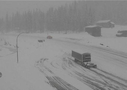
Both the Kootenay Pass and the Trans-Canada Highway between Revelstoke and Golden were closed Wednesday due to extreme weather conditions higher elevations.
The Drive BC website reported the Kootenay Pass was closed due to a vehicle accident and weather while a mudslide 60 kilometers west of Golden in Glacier National Park halted traffic.
While no rivers have overflowed banks in the regional, Macpherson still wanted to warn the public about dangers of getting too close to the water.
“We’re definitely not out of the woods yet . . . it’s usually the end of June when we have flooding issues so it’s a little early this year,” Macpherson explained.
“We want people to be aware the banks near the rivers could be softened up due to the rain and could be dangerous to the public.”
Other rivers on the RDCK watch include Moyie and Goat rivers in the East Kootenay and Salmo, Redfish and Duhamel in the west.
See also:
Flooding not expected for the Kettle, but high stream advisory issued


Comments