Parts of Genelle submerged as river level continues to rise; region offers flood updates

By Castlegar Source
Lower China Creek Road and 17th Avenue in Genelle have been submerged as river levels continue to rise, but BC Hydro’s Mary Anne Coules says crews are building a berm to make the road passable for residents. Coules said flows from the Hugh Keenleyside Dam had to be increased, however.
“Without the operation of upstream Treaty dams, the peak flow in the Columbia River in Castlegar and Trail would have been approximately double the current flow and very near the historic maximum flows seen in the major pre-dam flood years of 1948 and 1961,” she explained. “In order to manage Arrow Lakes Reservoir levels, flows from the Hugh L. Keenleyside dam are being steadily increased as the Kootenay River flows recede. As of July 11, the target flow on the Columbia River at Birchbank is 5,380 cubic meters per second (m3/s) or 190,000 cubic feet per second (cfs), and are expected to reach up to 5,520 m3/s (195,000 cfs) by July 13.”
She said BC Hydro crews are pitching in to ensure minimum hardship downstream.
“BC Hydro is working closely with local agencies and municipalities to assist in local efforts to protect homes and municipal infrastructure from that may result from the increased flows. In Genelle, BC Hydro is constructing a berm along the roadway by the river to maintain continued road access for local residents.”
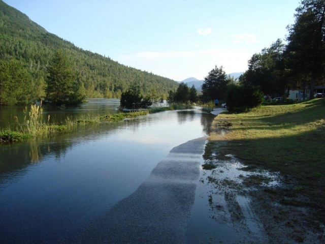
Meanwhile, in Castlegar the river impacts are being felt most in city parks, as Millennium Pathway remains partially submerged. The city issued this notice today, “The City of Castlegar has made the decision to close Zuckerberg Island until the flood waters recede from their current high. Flood waters rose considerably Tuesday night and a swift flow of water is breaching the causeway thereby placing a significant strain on the support wires for the bridge.”
Elswhere in the region, residents of the Slocan Valley West Road are no longer under evacuation alert, but not everyone is yet out of the woods, according to RDCK Emergency Operations spokesman Bill Macpherson.
“A portion of Area G remains under a state of local emergency as work continues at the HB mine site dam. The dam is stabilized and engineers are bringing in earth scanning equipment to ensure the sinkhole identified as a key cause of the slough is remediated completely. Buttressing and reinforcement of the dam will be finished prior to refilling the pond that was drawn down to relieve pressure. Emergency response crews and highway control personnel remain in place at this time.
“Kootenay Lake is dropping gradually and is expected to be at or below 1753 feet by midnight tonight. As flood events response decreases, the EOC will be moving into a recovery phase. Regular office hours will be observed unless a change is warranted.”


Comments