Mount Assiniboine Provincial Park closure to take effect immediately
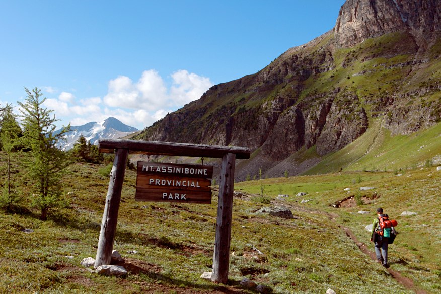
Mount Assiniboine Provincial Park, a popular tourist destination located west of the British Columbia-Alberta border 48 km southwest of Banff, has been closed immediately the Southeast Fire Centre said in a media release Sunday.
The decision, to close the park to inbound traffic effective immediately, was made by BC Parks, in co-ordination with the BC Wildfire Service, in an effort to protect public safety.
The closure will remain in effect until further notice.
“BC Wildfire Service resources are actively engaged with a 4,126-hecatre wildfire burning in Mount Assiniboine Provincial Park and, to ensure the safety of the public, this closure is necessary,” Karlie Shaughnessy Fire Information Officer for the BC Wildfire Service said in a media release.
“Mount Assiniboine Provincial Park is a high-alpine backcountry park accessible only by hiking trails, which would make an evacuation of the area difficult if it were needed. This proactive measure will enable a safe and orderly exit of the public from the area.”
Mount Assiniboine Provincial Park is roughly triangular in shape with the apex of this triangle is at the junction of the boundaries of Banff National Park, which forms the eastern boundary, and Kootenay National Park, which marks the boundary to the west.
The southern boundary follows the height of land above Daer Creek and Extension Creek from Kootenay National Park to the Mitchell River, then easterly to Banff National Park and the Continental Divide. The most popular hiking trails to the core area of the park start from Kootenay National Park to the west, and from Spray Lakes via Bryant Creek (Banff National Park) located south of Canmore, from Sunshine Meadows west of the Banff townsite, in Banff National Park, Alberta.
For more information about the closure, please visit the BC Parks website: www.bcparks.ca
The Southeast Fire Centre extends from the U.S. border in the south to the Mica Dam in the north and from the Okanagan Highlands and Monashee Mountains in the west, to the B.C.-Alberta border in the east. The Southeast Fire Centre includes the Selkirk Natural Resource District and the Rocky Mountain Natural Resource District.
To report a wildfire or open burning violation, call *5555 on a cellphone or 1 800 663-5555 toll-free. For the latest information on current wildfire activity, burning restrictions, road closures and air quality advisories, visit: www.bcwildfire.ca
You can also follow the latest wildfire news:
* On Twitter: http://twitter.com/BCGovFireInfo
* On Facebook: http://facebook.com/BCForestFireInfo












Comments