Snowfall warning in effect for Saturday night

By Nelson Daily Editor
By Timothy Schafer, The Nelson Daily
It’s déja vu all over again as a snowfall warning has been placed into effect for the Nelson region for Saturday night.
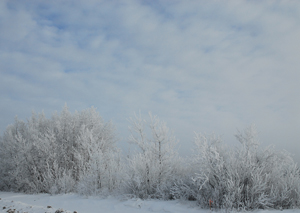
Up to 20 centimetres of snow are expected to fall tonight and through to Sunday morning across the region of the West Kootenay, including Nelson.
Environment Canada is warning that a moist Pacific frontal system will spread snow, at times heavy, to the West Kootenay beginning tonight.
Total snowfall amounts of 10 to 20 cm. are expected through to Sunday afternoon before changing to rain in most areas. The precipitation is expected to ease late Sunday as the system moves eastward.
The weather system could be called a bit of a mini-Pineapple Express, with the subtropical origin of the moisture, slightly higher temperatures and the large volume of precipitation. A true Pineapple Express would stay put for two or three days, leaving way more precipitation behind.
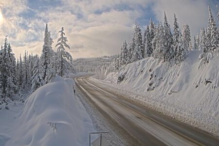
Unfortunately for skiers and boarders, the system has also pushes up temperatures — it was six degrees Celsius on Friday and it could be six degrees C on Sunday — and the snow line’s up above 2,000 feet.
That might mean rain for most of the local mountains. Around two cm. of snow has fallen in the last 24 hours on Whitewater Ski Resort, adding to the 124 cm. base of packed powder that it currently has.
In the second weekend before the season officially opens Dec. 17, 33 of 52 runs are open, and three of four lifts (not the Glory Ridge lift) are operating.
In the backcountry, new wind slabs of snow are forming on top of a weak upper snowpack in response to new snow and wind, making the areas on the mountain ripe for avalanches.
Denser new snow is falling on weaker snow surfaces, according to the Canadian Avalanche Centre. Storm slabs are possible, even in sheltered locations, when 30-40 cm of snow or more sits on the old snow surface.
Special message
Some areas have reached critical loading on the first major weak layer of the season. Successive storms will bring in a bit more snow, triggering will become more likely, and avalanches will be larger.
Warning
The timing and intensity for a storm Sunday is uncertain.
Snow amounts of 15-25 cm. range are expected. Ridgetop winds coming out of the west are at 40-65 km/h, with freezing levels remaining around 1,200 metres.
Avalanche activity
Recent reports include naturally occurring wind slab avalanches large enough to bury a person and up to 40 cm. deep in open tree line and low alpine terrain.
Wind slabs and storm snow weaknesses are susceptible to human triggers with reports of small slope-cuts, “whumpfing,” and shooting cracks.
Travel advisory
Areas to avoid:
• Slide paths with alpine start zones during heavy or prolonged periods of snowfall.
• Large wind loaded north aspect slopes
Areas of concern:
• Wind-loaded slopes in alpine and open treeline areas.
• Slopes exopsed to terrain traps.
Techniques to manage risk:
Watch for obvious signs of instability such as recent avalanches, “whumpfs,” shooting cracks or hollow sounding patches of wind slab.
Perform slope-cuts on small slopes, snowpack tests, or even quick hand shear tests to determine the sensitivity and distribution of the surface hoar, wind slab, and storm snow weaknesses.
Enter your line low or avoid the steepest top part of the slope using ridges and ribs to get below the pillows at the top.
Snowpack
In sheltered areas, approximately 30-40 cm. of storm snow sits on a buried surface hoar layer that we suspect exists in the alpine in shaded areas, at tree line and below tree line.
On southern aspects, the new snow lies on an unsupportive sun crust.
Around 110 cm. of snow exists at tree line elevations. There are some reports of facets on the rain crust near the ground.
Prepared by Cam Campbell


Comments