B.C. Hydro begins process of dredging Grohman Narrows by surveying river bottom

By Bruce Fuhr
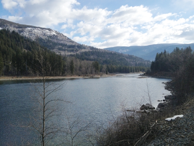
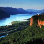
Record water levels and flooding on Kootenay Lake in 2012 has prompted B.C. Hydro to begin studies on the possibility of dredging a three-kilometer stretch of the body of water west of Nelson known as Grohman Narrows.
The stretch of Kootenay River, located a few kilometers down stream from the Heritage City, has been blamed for years for slowing the river flows during high water season in the spring.
Not only does the river bottleneck at Grohman but silt and sand from the river is believed to have built up over the years adding to the slowing of the river flows.
“The potential benefits of dredging is to, number one, improve flood control on Kootenay Lake, and two, to better operating control for the entire Kootenay system better power benefits all along the Kootenay river in Canada and the USA,” B.C. Hydro spokeswoman Mary Anne Coules.
Coules said the study, costing in the range of $70,000, came as a result of stakeholders in the community urging Hydro consider the solution.
The initial study, happening over the next 10 days, will have a boat patrolling Grohman Narrows with equipment that can survey the river bottom.
The part of the procedure does not require permits or licenses from government.
However, other stakeholders in the power generating business, including FortisBC, Nelson Hydro and US Army Corps of Engineers, have been contacted about the study by B.C. Hydro.
“Over the next 10 days we’ll be able to find out what the bottom of the river looks like and if dredging is a viable option,” Coules explained.
“But we won’t know until we get down there and see what the bottom looks like.”
Kootenay Lake is one of the largest in B.C., at more than 104 kilometers in length and three to five kilometers in width.
The mouth of Kootenay Lake begins in the East Kootenay near Canal Flats, running into the United States before re-entering Canada at Creston.
Waters also feed the lake from the Kaslo and Duncan Rivers in the north.
Kootenay Lake turns into Kootenay River near Nelson before joining the Columbia River at Castlegar.
Coules, who said the last time the river was dredged was in the 1930s, said the project is in its initial stage. And more information must be collected before a final decision on dredging can be made.
“It’s at least a couple of years before we could go ahead,” said Coules.
“Doing the field work is good but we need to discuss all the issues that people have about the project before we make a decision to go forward.”


Comments