More bad news for Johnsons Landing, another potential land slide could be on the way

By Erin Perkins
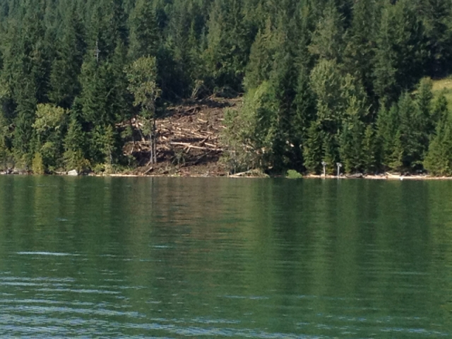
After doing some ground work investigation at the Johnsons Landing slide head, geotechnical experts are warning another slide of the same magnitude as the one earlier this year is possible.
The experts spent last week exploring the site at the ground level and discovered tension cracks and slope displacement of up to four meters about 200 meters above the summer landslide, said Francis Maika, public information officer with the Central Kootenay Regional District (RDCK).
The 12 properties and 11 people that may be affected by this new potential are all within the evacuation order area that was created around the slide path that happened in July, said Maika.
The results of the field work were presented by the Multi-agency Recovery Team (MRT) when they met with the three community members of the Johnsons Landing Advisory Group earlier this week.
Many of the residents are still unable to return to their homes and continue to live with family and friends or in temporary homes.
During this assessment, the geotechnical team determined that there is no evidence of there having ever been a slide of that magnitude — 300,000 meters cubed — that has travelled further than the most recent landslide since deglaciation.
This newest assessment confirmed the data already mapped out on an existing RDCK high hazard map made of the slide area earlier this summer.
Included in a list of high risk areas is Gar Creek, the road crossing at Gar Creek, the area around the destroyed house in that same area and a portion of the public beach.
“The next step in the geotechnical assessment for Johnsons Landing is to perform landslide run-out modeling,” said Maika in an email.
“In this step, data gathered from the landslide area, including mapping information before and after the slide, as well as other field measurements, is fed into a computer model that is designed to generate virtual landslide scenarios showing where possible future landslides and debris flows could go if conditions once again triggered another landslide and related debris flow.
“This is a theoretical exercise in which geoscientists and geotechnical engineers cooperate to determine likely landslide outcomes and provide more accurate landslide hazard information to the community of Johnsons Landing as well as to interested agencies and government.”
With this new information, Deb Borsos, recovery manager, the advisory group and the RDCK will be working with the individual property owners and residents who are most affected by the high risk areas on the hazard mapping so that they may make informed decisions about their future plans for their homes and lives.
The mudslide, which hit the small hamlet of about 35, killed four people and wiped out four houses and damaged two others on the morning of Thursday, July 12.


Comments